Browse Items (2 total)

  • Collection: 1836 Treaty of Washington

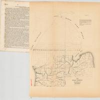
Sketch of the public surveys in the north part of Michigan.

G4111B51837-U5.jpg
Map detached from a United States Senate document in the United States congressional serial set (Serial Set 314 S.doc.11): Report from the Secretary of the Treasury, with the annual report of the Commissioner of the General Land Office.
"December…

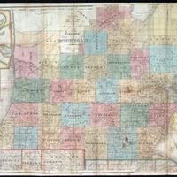
An improved edition of a map of the surveyed parts of the Territory of Michigan
843-A-1836-farmer_JPG_HIGH.jpg
Covers southern Michigan.
Insets: Map of the Straits of Michillimackinac. -- Map of Pte. Ste. Ignace. -- Map of the most important parts of the lead mine district near the Mississippi River. -- Map of the private claims at Green Bay -- Map of…