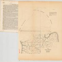
Sketch of the public surveys in the north part of Michigan.
Dublin Core
Title
Sketch of the public surveys in the north part of Michigan.
Subject
Treaty of 1836
Description
Map detached from a United States Senate document in the United States congressional serial set (Serial Set 314 S.doc.11): Report from the Secretary of the Treasury, with the annual report of the Commissioner of the General Land Office.
"December 13, 1837--Read, and ordered to be printed..."--Page [1] of associated Senate document.
Includes notes.
Map of the northern part of Michigan's lower peninsula (north of the Michigan Base Line), with a green line separating old survey areas from those where surveying work is in progress. Shows rivers and river names, with some rivers varying from their present names: the Muskegon River is shown as "Maskego R."; the Macatawa River is shown as "Black R."; the Rogue River is shown as "Rouge R."; the Tittabawassee River is shown as "Tetabawassee R."; the Shiawassee River is shown as "Shiawasse R."
Creator
US Land Survey
Source
Michigan State University
Publisher
United States. General Land Office, United States. Congress Senate, and United States. General Land Office
Date
1837
Contributor
Kathleen Weesie, archivist
Rights
Pubic Domain
Collection
Citation
US Land Survey, “Sketch of the public surveys in the north part of Michigan.,” Agroecology of Western Michigan, accessed September 19, 2024, https://ottojays.reclaim.hosting/cms/items/show/269.

